"Earth from Space with Stars" by DonkeyHotey is licensed under CC BY 2.0.
Introduction:
Welcome back to the third part of our journey through the Pleistocene epoch, also known as the Ice Age, as we explore Book Two, Chapter One. In this instalment, we delve deeper into the intricacies of ice ages, the massive ice sheets that shaped our planet, and the incredible geological features they left behind.
The Dance of Ice Ages and Greenhouse Periods:
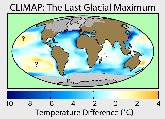
An ice age is a prolonged period of cooling on Earth, characterized by the expansion of continental and polar ice sheets and alpine glaciers. Earth's climate oscillates between these ice ages and greenhouse periods, where glaciers recede. Our planet finds itself amid an ice age known as Quaternary glaciation. Within ice ages, we experience individual episodes of frigid climate, referred to as glacial periods. Conversely, the warmer intervals punctuating ice ages are known as interglacials or interstadials.

This image was prepared by Robert A. Rohde from published data and is part of the Global Warming Art project.
The Chilly Effects on Sea Levels and Land Bridges:
During the Pleistocene ice age, the Earth's temperature plummeted significantly. This dramatic cooling had far-reaching consequences, most notably the reduction of sea levels. As ice sheets grew, vast quantities of water became locked in glaciers, leading to a drop in sea levels. This lowering of sea levels exposed land bridges between continents, providing migration pathways for diverse animal species. These land bridges played a pivotal role in shaping global ecosystems and the distribution of life on Earth.

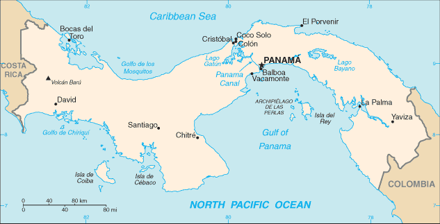
Map of Panama, converted directly from CIA World Factbook GIF Source en:Image:Pm-map.png {{PD-USGov-CIA-WF}}
The Isthmus of Panama is a land bridge whose appearance 3 million years ago enabled the Great American Biotic Interchange, in which animals and plants from the north colonized the south and vice versa.
The Last Glacial Maximum and Vanishing Ice:
The world looked vastly different at the peak of the most recent ice age, approximately 20,000 years ago. Sea levels were a staggering 130 meters lower than they are today. This remarkable drop resulted from the substantial evaporation and subsequent deposition of seawater as snow and ice, primarily within the Laurentide Ice Sheet.
The Laurentide Ice Sheet: A Geological Giant:
The Laurentide Ice Sheet, a colossal expanse of ice, covered millions of square miles during various Quaternary glacial epochs spanning from 2.58 million years ago. Its last significant advance occurred between approximately 95,000 and 20,000 years ago. This colossal ice sheet had a profound impact on the landscape.

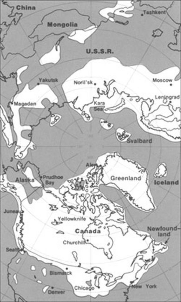
image from https://pubs.usgs.gov/gip/continents/map.jpg
The maximum extent of glacial ice in the north polar area during the Pleistocene period included the vast Laurentide ice sheet in eastern North America.
Scars of the Ice Sheet:
The Laurentide Ice Sheet advanced and retreated, leaving an enduring mark on the Earth's surface. It carved out the five Great Lakes and numerous smaller lakes across the Canadian Shield. These lakes stretch from the Northwest Territories through Canada to the upper Midwest of the United States, including Minnesota, Wisconsin, and Michigan. The ice sheet's influence extended further, shaping regions as far south as New England and Nova Scotia and impacting coastal cities like Boston, New York City, Chicago, and St. Louis. Beyond, it merged with the Cordilleran Ice Sheet, leaving an indelible imprint on the landscape.
Conclusion:
The Pleistocene epoch, with its ice ages and interglacials, reveals a dynamic Earth undergoing remarkable transformations. The Laurentide Ice Sheet's dominance and retreat are just a glimpse into the profound influence of ice on our planet's geography and climate. As we continue our journey through Earth's frozen past, we will uncover more secrets of this intriguing epoch and its impact on life on Earth. Stay tuned for the next instalment in exploring the Pleistocene Ice Age!
Leave a Reply